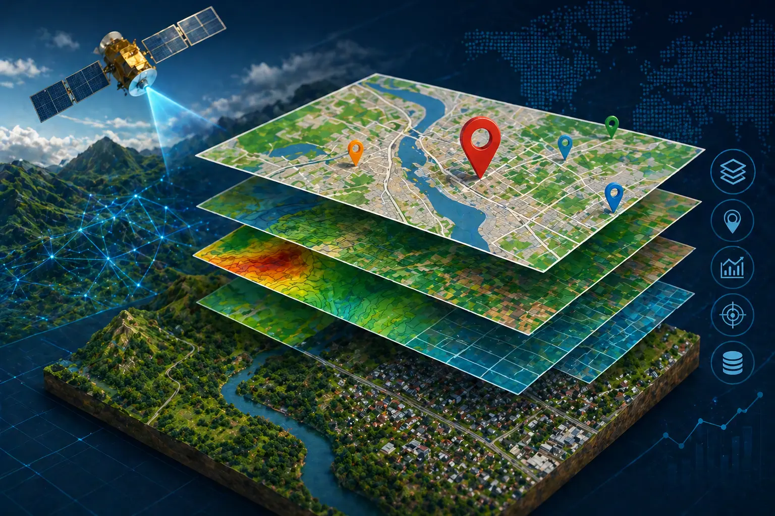
GIS Mapping & Data Services
GIS mapping for land, boundary, and plot mapping services.
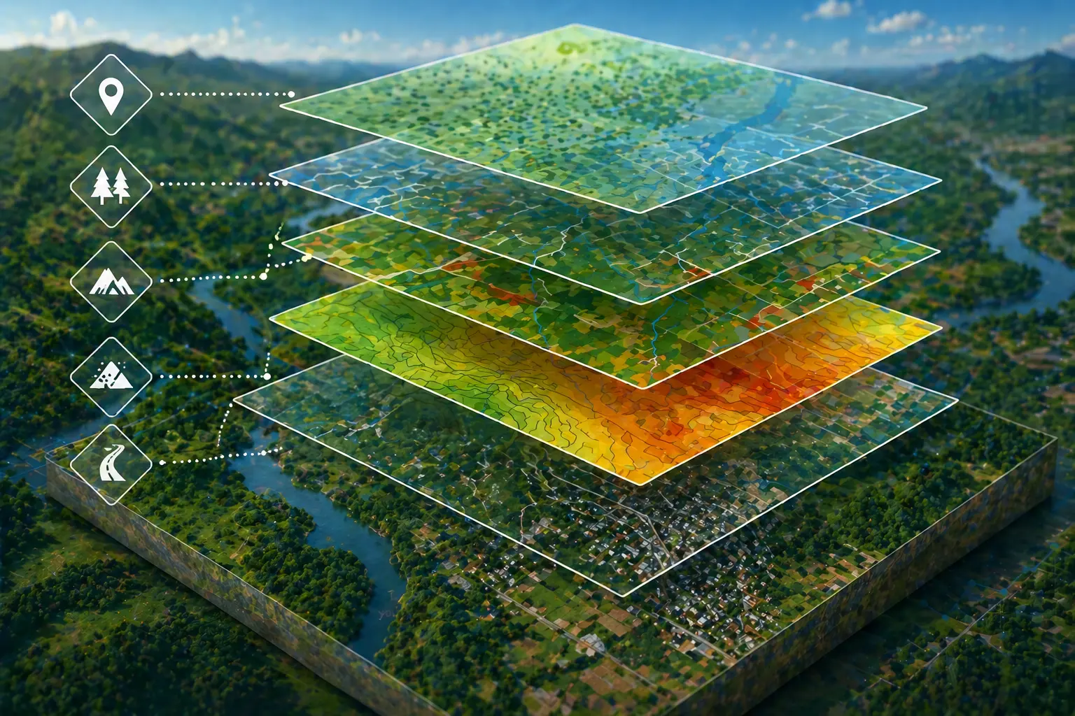
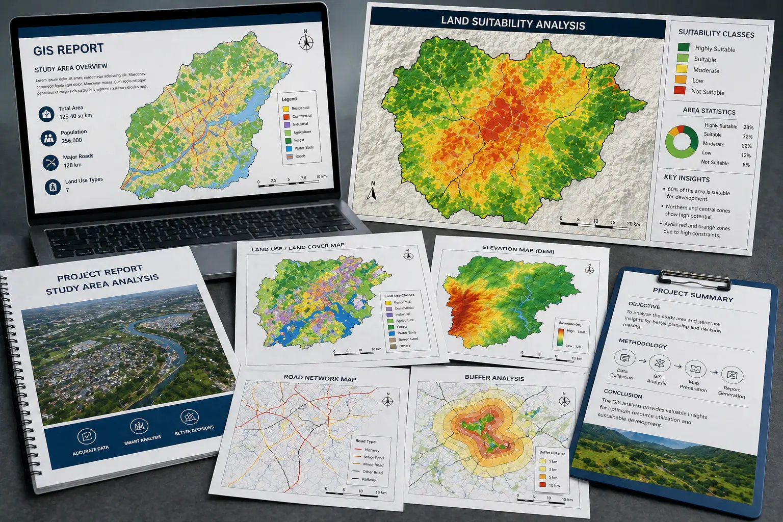
Site Analysis & Suitability
Basic GIS site analysis and land suitability mapping.

Web Mapping & Interactive Maps
Solar site screening and land suitability mapping services.
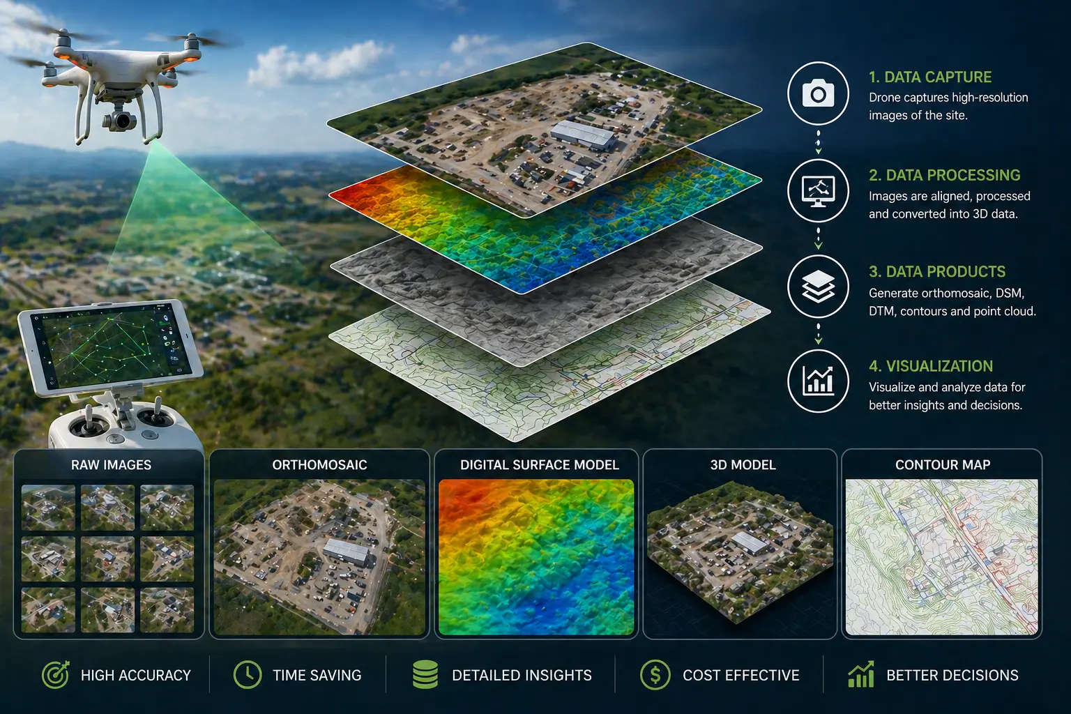
Drone Data Processing & Visualization
Interactive maps and location-based web mapping solutions.
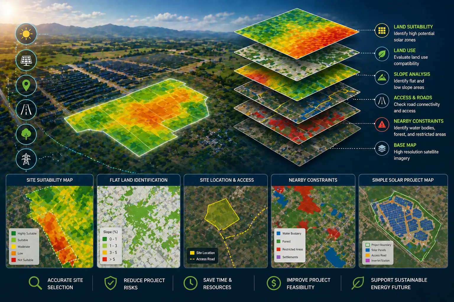
Solar GIS & Site Screening
Drone image processing and orthomosaic map creation.
GIS Reports & Presentation Maps
Presentation-ready GIS maps for reports and projects.


