Drone Data Processing & Visualization
Drone Image Processing
We process raw drone images to enhance quality, correct distortions, and prepare them for GIS analysis. This involves aligning multiple images, improving clarity, and ensuring geographic accuracy. The processed data becomes suitable for mapping, measurement, and visualization purposes. It is the first essential step in converting drone data into usable outputs.
What We Do
- Import and organize raw drone imagery
- Perform image correction and alignment
- Enhance image quality and clarity
- Prepare data for further GIS processing
Deliverables
- Processed drone images
- Clean and corrected image dataset
- GIS-ready imagery files
- Structured data output
Benefits
- Improves image accuracy and quality
- Prepares data for mapping and analysis
- Ensures reliable project outputs
Deliverables
- High-resolution orthomosaic map
- Geo-referenced raster file
- Ready-to-use map for analysis
Benefits
- Accurate and detailed ground representation
- Supports measurement and analysis
- Ideal for large area mapping
Orthomosaic
Orthomosaic creation combines multiple drone images into a single, seamless, and georeferenced map. This map represents the ground accurately without distortions, making it ideal for measurements and analysis. It provides a real-world view of the area with high resolution and precision. Orthomosaics are widely used in surveying, construction, and land monitoring.
What We Do
- Stitch multiple drone images together
- Georeference the final output
- Correct distortions and align images
- Generate high-resolution orthomosaic maps
Site Visualization
Site visualization helps you understand your project area through detailed aerial views and map-based representations. We create clear and visually appealing outputs that highlight key features of the site. This makes it easier to present, analyze, and communicate project details. It is especially useful for planning, reporting, and client presentations.
What We Do
- Create visual maps from drone data
- Highlight important site features
- Design clean and professional layouts
- Prepare outputs for presentations
Deliverables
- Visual site maps
- High-resolution images
- Presentation-ready outputs
Benefits
- Better understanding of site conditions
- Improves communication with clients
- Enhances presentations and reports
- Supports planning and decision-making

Deliverables
- Boundary overlay map
- GIS boundary layer
- High-resolution map output
Benefits
- Clear visualization of land boundaries
- Improves accuracy in land identification
- Useful for legal and planning purposes
- Enhances overall map clarity
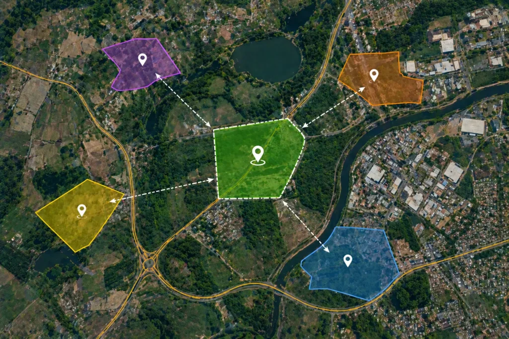
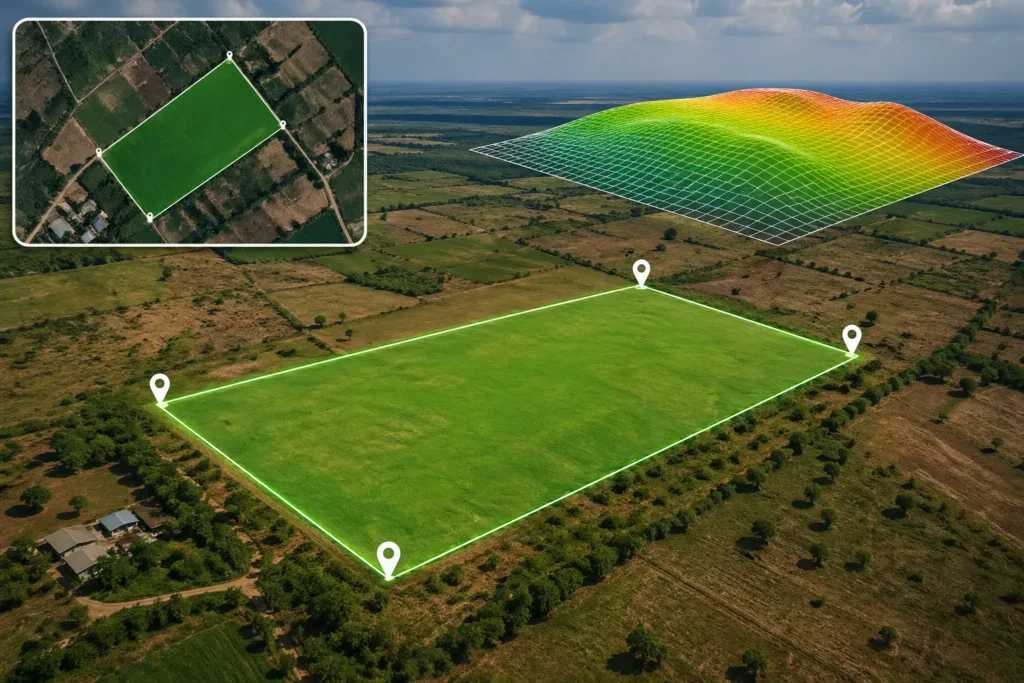
Boundary Overlay
Boundary overlay involves placing accurate land boundaries on top of drone imagery for clear visualization. This helps in identifying exact land limits in relation to real-world features. It is useful for land verification, planning, and documentation purposes. The result is a precise and easy-to-understand map combining imagery and boundaries.
What We Do
- Overlay boundary data on drone images
- Align GIS boundaries with imagery
- Highlight plot or project limits
- Ensure accurate spatial positioning