Site Analysis & Suitability
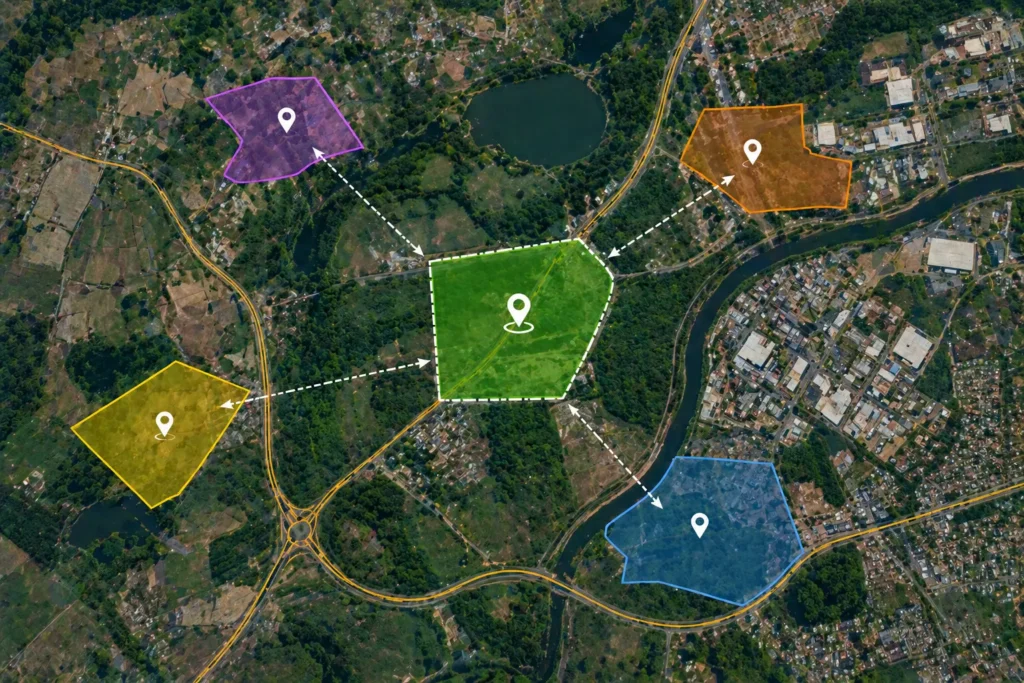
Site Selection
We help you identify the most suitable location for your project using GIS-based analysis and satellite data. Our process considers factors like accessibility, surrounding land use, and nearby infrastructure to ensure practical decision-making. This service is ideal for early-stage planning where selecting the right site is critical. It helps reduce uncertainty and improves overall project success.
What We Do
- Analyze available land using satellite imagery
- Evaluate location based on roads, nearby areas, and land use
- Identify suitable zones for your requirement
- Provide map-based recommendations
Deliverables
- Site selection map
- Location analysis report
- Basic recommendation summary
Benefits
- Saves time in land selection
- Better decision-making
- Reduces risk of wrong location choice
Deliverables
- Land suitability map
- Classification of land zones
- Simple analysis report
Benefits
- Helps choose the right land use
- Avoids unsuitable locations
- Supports planning decisions
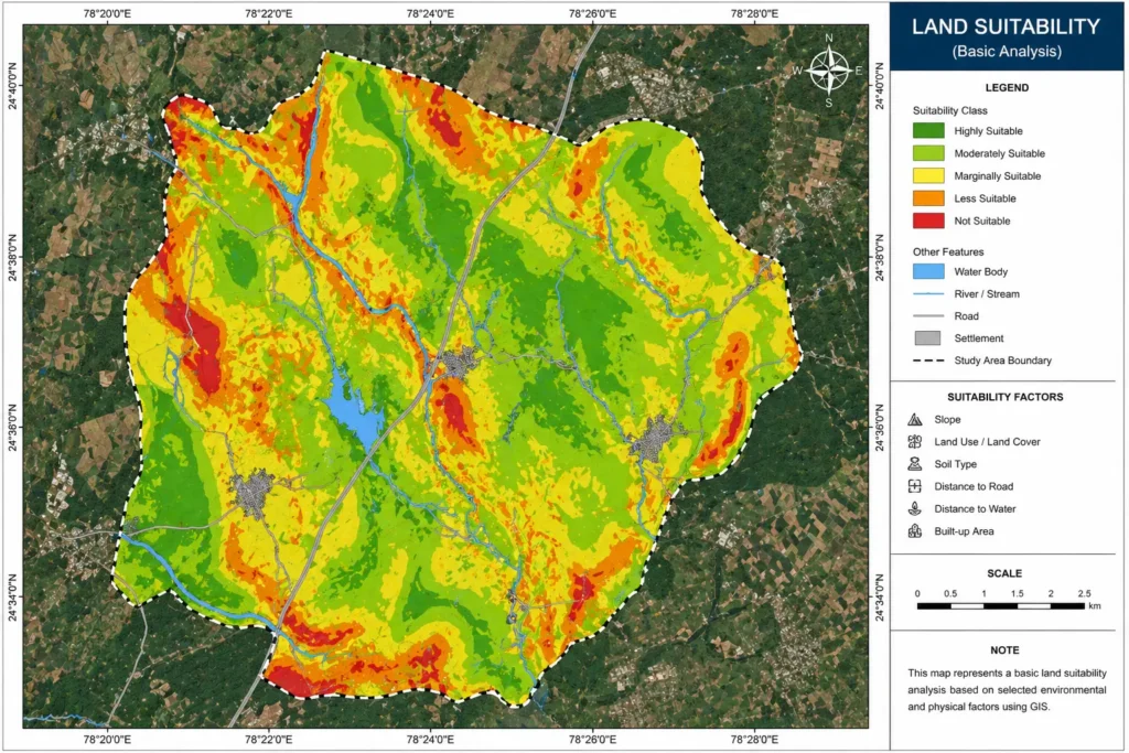
Land Suitability
This service evaluates whether a piece of land is appropriate for a specific purpose such as residential, agricultural, or commercial use. We analyze basic parameters like land use, terrain, and surrounding environment to classify areas based on suitability. The output provides a clear understanding of which zones are favorable or not. It helps in making informed and risk-free land use decisions.
What We Do
- Evaluate land based on slope, land use, and surroundings
- Analyze basic environmental conditions
- Classify land into suitable / less suitable areas
- Provide visual suitability maps
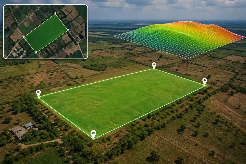
Flat Land Identification
We identify flat or low-slope land areas using elevation and terrain data for better planning and development. Flat land is crucial for construction, farming, and infrastructure projects as it reduces cost and effort. Our analysis highlights suitable zones visually on maps for easy understanding. This ensures efficient site selection and smoother project execution.
What We Do
- Analyze terrain using elevation data
- Identify flat and gentle slope areas
- Highlight suitable zones on map
- Provide easy-to-understand outputs
Deliverables
- Flat land map
- Slope-based classification
- GIS data layer
Benefits
- Ideal for construction planning
- Reduces development cost
- Easy site preparation

Deliverables
- Constraint map
- List of nearby features
- Spatial overview report
Benefits
- Avoids risky locations
- Better planning and compliance
- Improves project safety
Nearby Constraints Mapping
This service focuses on identifying limitations or risk factors around a selected site using GIS mapping. We analyze nearby features such as water bodies, roads, restricted zones, and environmental areas that may impact your project. The output helps you clearly understand potential challenges before starting development. It supports safer and more compliant planning decisions.
What We Do
- Map nearby features and restrictions
- Identify risk zones around site
- Analyze surroundings using GIS layers
- Create clear constraint maps
Spatial Analysis
We perform basic spatial analysis to understand geographic patterns, relationships, and simple insights from your data. This includes proximity analysis, overlay mapping, and location-based evaluation using GIS tools. The results are presented through clear and easy-to-understand maps. It helps improve planning accuracy and supports better decision-making.
What We Do
- Perform overlay analysis
- Analyze proximity (distance to roads, water, etc.)
- Generate simple GIS insights
- Create visual maps for understanding

Deliverables
- Analysis maps
- Basic GIS report
- Data layers for reference
Benefits
- Better understanding of land data
- Supports smart decision-making
- Useful for multiple industries