Solar GIS & Site Screening
Solar Site Screening Maps
We create solar site screening maps to identify and visualize potential locations suitable for solar energy projects. These maps combine multiple spatial factors such as land use, terrain, and accessibility to highlight viable zones. The output helps quickly shortlist locations for further evaluation. It is an essential first step for solar project planning.
What We Do
- Analyze land using satellite imagery and GIS layers
- Identify potential solar zones
- Combine multiple criteria into one map
- Highlight suitable and unsuitable areas
Deliverables
- Solar site screening map
- GIS data layers
- Shortlisting of potential locations
- Map-based analysis output
Benefits
- Quick identification of suitable sites
- Saves time in land selection
- Reduces project risk
- Supports early-stage decision-making
Deliverables
- Land suitability map for solar
- Classified zones (suitable / less suitable)
- Basic GIS analysis report
- GIS-compatible data files
Benefits
- Helps select optimal land for solar
- Avoids unsuitable or risky areas
- Improves planning accuracy
- Saves cost in project development
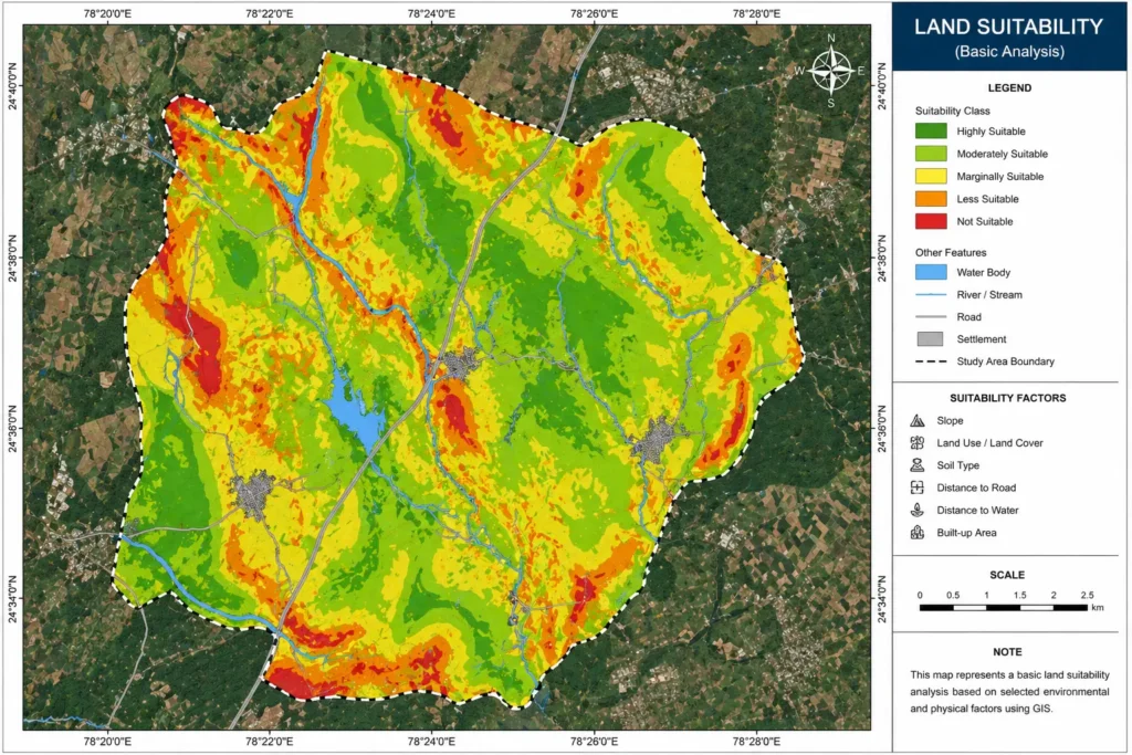
Basic Land Suitability for Solar
This service evaluates whether a land parcel is suitable for solar installations based on basic GIS parameters. We analyze factors such as land use, slope, and surrounding environment to classify suitability levels. The output provides a clear understanding of where solar development is feasible. It helps avoid unsuitable locations and improves project efficiency.
What We Do
- Analyze land use and terrain conditions
- Evaluate slope and surface characteristics
- Classify land into suitability categories
- Generate clear suitability maps
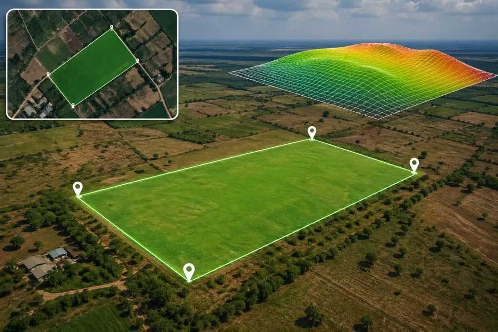
Flat Land Identification for Solar Projects
We identify flat or low-slope land areas that are ideal for solar panel installation. Flat terrain is critical for maximizing efficiency and reducing installation complexity. Using elevation and slope analysis, we highlight suitable zones for solar projects. This ensures better performance and easier project execution.
What We Do
- Analyze terrain using elevation data
- Identify flat and low-slope areas
- Highlight suitable zones on maps
- Prepare easy-to-understand outputs
Deliverables
- Flat land map for solar
- Slope classification map
- GIS data layer
- Visual analysis output
Benefits
- Ideal land for solar installation
- Reduces construction complexity
- Improves energy efficiency

Deliverables
- Location and access map
- Road and connectivity analysis
- GIS map output
- Map layout for reports
Benefits
- Better planning of site access
- Improves logistics and operations
- Saves time during execution
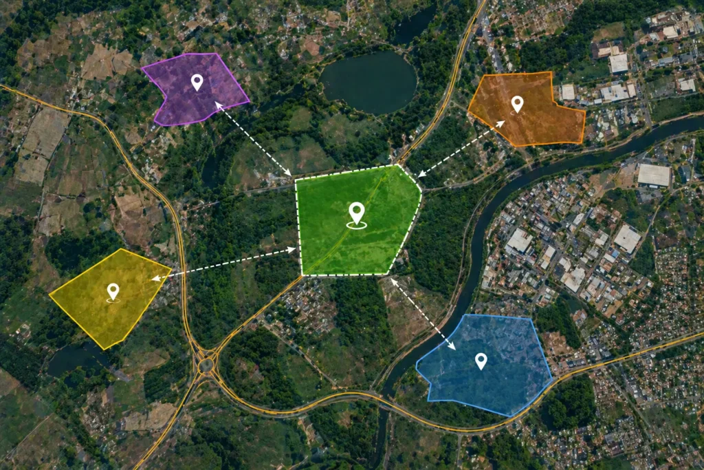
Site Location & Access Mapping (Solar)
This service focuses on mapping the location of solar sites along with accessibility features such as roads and nearby infrastructure. Easy access is important for installation, maintenance, and operations. We provide clear maps showing how to reach the site and its connectivity. This helps in practical planning and logistics.
What We Do
- Map site location accurately
- Analyze nearby roads and access routes
- Highlight connectivity and infrastructure
- Create clear and readable maps